
Materials and resources
Liquid maps
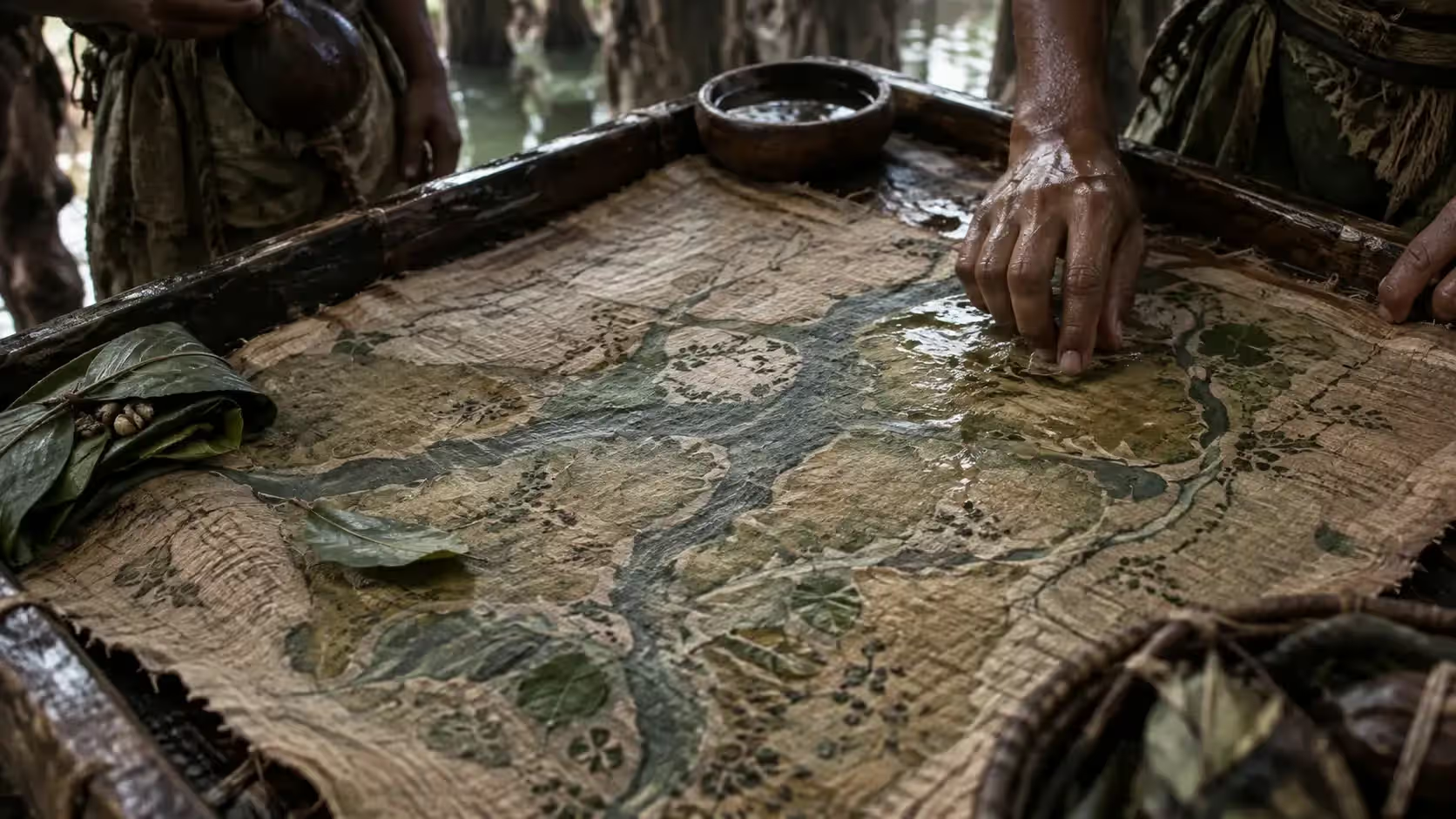
N’Goro’s maps layer strata, moisture, reactive pigments, smells and indicator organisms; true yesterday, they may be false today.
A map that lives
N’Goro’s maps combine layers, moisture, reactive pigments, smells and indicator organisms.
A map can be true yesterday, false today and dangerous tomorrow. Some must be fed or renewed. Channels rise, fall, close or change direction, and the map has to follow.
Reading again before leaving
A guide cannot present an old route as a sufficient promise: the signs must be read again before committing travellers, animals or a cargo. The Knotters of Yveth, at once messengers, gardeners, map-makers, spies and warriors, maintain the living routes these maps describe.
Map knowledge is also a defence. When N’Goro is invaded, the first threshold of its resistance is the route: guides vanish, maps become false, ports close.
Reading a liquid map
A liquid map is not read at a glance. The reader unrolls it on a damp board, out of the sun, and reads it in three ways at once. First he looks at the colours: the reactive pigments shift with the moisture and warmth of the waters they stand for, so that a pass that has cooled or an arm that has warmed changes hue on the map. Then he smells the scented fibres sewn along the channels: a bitter smell marks dangerous water, a smell of resin confirmed water, no smell at all a stretch that has not been read again. Finally he watches the indicator organisms lodged in their wax cells, whose behaviour tells the state of the waters they accompany.
This reading takes years to learn. Apprentice cartographers begin by smelling, blindfolded, fibres whose origin is kept from them, and must know a water by its smell before they are allowed to depict it. An experienced guide reads a map in a few minutes; a foreigner sees only a stained cloth smelling of mud.
Route maps, basin maps and pass maps
The Ngoro distinguish several kinds of liquid map by their extent and their lifespan. The route map describes a water route from end to end for one season: it is the one ordered by master carriers, Shedding Village pilots and merchants, and which the cartographers undertake to maintain for as long as the contract lasts. The basin map shows a single lake or basin, with its coded waters, its depths and its dangers; it stays at the reading post or with the water keeper, and is fed without a break for years. The pass map, finally, is no bigger than a hand and is good only for one pass and a few days: guides carry it on them and burn it once the crossing is done.
The largest maps in the country are kept at the Sacred Lakes, in the schools of the Living Mirror. They cover whole regions, are remade with every flood, and the arbiters of the Circle of Balances come to consult them when two clans dispute a water.
Keeping a map alive
A liquid map dies if it dries out. Those that are carried travel rolled in a bamboo or horn case with a piece of water-soaked spongy crystal at the bottom, and their bearer keeps them against his body, under his clothes, out of the sun and the cold. Every evening he checks that the case is damp and that the organisms are still alive; if he crosses salt water or a spore-laden mist, he protects the map under waxed cloth, for a map that has taken in the water of another basin can change its colours and lie.
The reading posts keep theirs in chests of living wood set on racks above the water, and the cartographers visit them every morning to feed them. Between two feedings a map is as fragile as a patient: it is not folded, not lent, and touched as little as possible.
Maps and the law of waters
In N’Goro a liquid map is not only a tool for travel: it also serves as proof. When two clans share a basin, the arbiters often have a basin map drawn up that both parties feed together, taking turns, and on which each side’s limits are sewn. As long as the map lives, the agreement holds; if one of the clans stops feeding it, it is deemed to have given up its share. The cartographers of the Living Mirror are called as witnesses in such cases, and their reading is authoritative before the Circle of Balances.
A stolen or captured map is not useful for long. Invaders who have laid hands on liquid maps found that they stopped telling the truth after a few weeks, for want of feeding, and that they could not read them anyway. So the Ngoro hardly fear having their maps taken; they fear having their cartographers taken.